
Transforming the Future with Space Technology
- Mr_Solid.Liquid.Gas
- Sep 8, 2025
- 5 min read
Space Technology in Daily Life: GNSS, Earth Observation & Satellite Communications

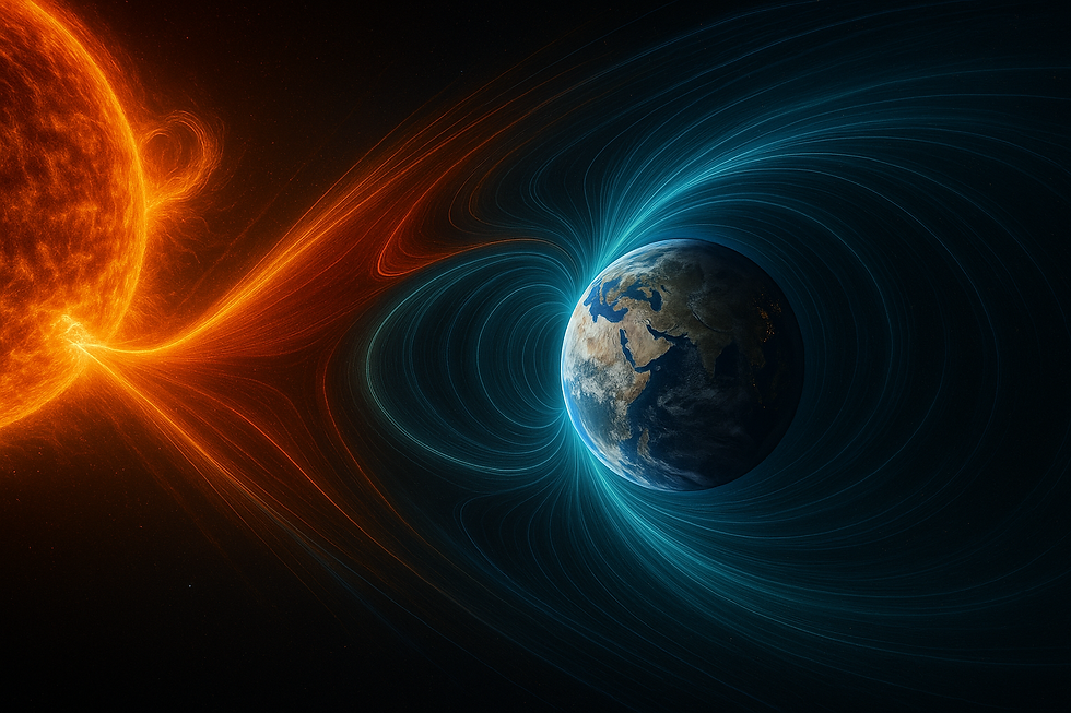
Space technology isn’t only rocket launches and astronauts. It’s the invisible backbone of everyday services—from ride‑hailing and grocery deliveries to precision agriculture and emergency response—and a critical enabler of the green transition. Global Navigation Satellite Systems (GNSS), Earth Observation (EO) satellites, and satellite communications (satcom) feed trusted, time‑stamped, location‑aware data into almost every industry. As economies digitise and decarbonise, this space‑to‑ground data loop becomes climate intelligence, universal connectivity, and resilient digital infrastructure. This article shows how satellite technology already powers daily life, how remote sensing analytics drive environmental decision‑making toward net zero, why connectivity is expanding via satellite internet and 5G NTN, and what’s next with in‑space manufacturing and on‑orbit servicing.
FAQs
Q1: What is GNSS and how is it used in daily life?
A: GNSS provides precise positioning and timing for navigation, logistics, banking timestamps, and precision agriculture.
Q2: How do climate monitoring satellites support net‑zero?
A: They deliver remote sensing analytics—from methane detection to deforestation tracking—that strengthen ESG data and net‑zero planning.
Q3: What is 5G NTN?
A: 5G non‑terrestrial networks integrate satellites with mobile standards, extending satellite internet and satellite IoT to remote areas.
Q4: What are space tugs and on‑orbit servicing?
A: Space tugs dock with satellites to extend life; OOS enables inspection, refuelling and upgrades, supporting the orbital economy and space sustainability.
From Orbit to Everyday: GNSS Applications, Earth Observation & Satcom in Daily Life

Open a maps app to meet the most familiar face of space: GNSS. Constellations orbiting Earth broadcast timing and positioning signals that phones, cars, aircraft and tractors use to know precisely where they are—core GNSS applications that underpin navigation and logistics. That single capability unlocks a chain of everyday benefits: ride‑hailing and food‑delivery apps match drivers to customers in seconds; delivery fleets optimise routes on the fly to cut fuel use and delays; cyclists and runners log accurate distances without a thought.
Precision timing—also derived from space—quietly safeguards finance and telecoms. Banking systems synchronise trades and payments to trusted satellite time, producing reliable banking timestamps that can be audited and sequenced. Mobile networks use ultra‑precise timing to keep millions of devices in sync; remove space timing for a day and much of the digital economy would stutter. These satellite communications timing signals are essential for telecom network synchronisation.
Earth Observation completes the picture. High‑revisit satellites provide fresh satellite imagery and remote sensing analytics that help cities plan roads and EV charging points, utilities monitor infrastructure, and insurers assess risk. In precision agriculture, satellite‑guided tractors steer straighter lines while EO‑derived vegetation indices flag where crops need water or nutrients—reducing inputs, improving yields and cutting emissions. Crop‑spraying becomes targeted rather than blanket, saving farmers money and keeping chemicals out of waterways.
When things go wrong, space steps in again. During floods, fires or earthquakes, responders rely on EO maps to see the full picture through smoke or cloud. Satcom delivers connectivity when terrestrial networks are damaged, helping emergency teams coordinate and families check in. This combination of GNSS, EO and satcom is foundational for disaster response and civil resilience—satellites are the quiet partner making modern life smoother and safer.
Climate Intelligence from Space: Climate Monitoring Satellites & Methane Detection

Decarbonisation is a data problem as much as an engineering one. Organisations need accurate, frequent and comparable evidence of what is happening on the ground—and over the oceans—to plan effectively and prove progress. Climate monitoring satellites now track key signals at global scale: methane detection of super‑emitters, deforestation frontiers, wildfire perimeters, glacier retreat, urban heat islands, ocean colour remote sensing linked to phytoplankton health, and broader land‑use change. These data streams feed environmental, social and governance (ESG) reports, sharpen net‑zero roadmaps, and inform regulation and finance.
Mini case study—methane detection over oil basins:
Methane is a potent greenhouse gas with outsized short‑term warming impact. High‑resolution satellite imagery and hyperspectral sensors can spot concentrated methane plumes over oil and gas fields, landfills and pipelines. When a plume is detected, operators can be alerted within hours to investigate, prioritise repairs, and verify that emissions drop afterwards. This turns what used to be sporadic, manual leak detection into continuous basin‑scale monitoring—reducing emissions faster and with better accountability.
EO also helps prevent greenwashing. Independent satellite data can verify forest offsets, confirm whether a supply chain is linked to new deforestation, or quantify the real impact of restoration projects. Combined with on‑the‑ground sensors and modelling, space‑borne observations transform sustainability from a narrative to a measurable plan of action, strengthening ESG data quality and aligning disclosures with net‑zero pathways.
Connectivity Everywhere: Satellite Internet, 5G NTN & Satellite IoT

Connectivity is no longer a binary of ‘on‑grid’ or ‘off‑grid’. Non‑terrestrial networks (5G NTN) integrate satellites with mobile standards, extending satellite internet to rural and remote users and restoring coverage in disaster zones. Traditional satellite links already keep ships, aircraft and remote worksites online. The next wave makes it seamless so ordinary devices can connect when cell towers are out of reach.
For industry, satellite IoT unlocks low‑power sensors that report from anywhere: cold‑chain trackers that ensure vaccines stay within temperature bands; wildlife collars that inform conservation; utility monitors that watch pipelines, smart meters and grid assets across vast distances. Maritime and aviation operators gain resilient links that support navigation updates, weather avoidance, maintenance telemetry and crew welfare—even thousands of kilometres from shore.
Cost curves are trending down as mass‑produced low Earth orbit (LEO) constellations, flat‑panel antennas and cloud‑native ground systems scale up. At the same time, edge AI in space processes data before it hits the ground, filtering normal readings and flagging anomalies in near‑real time. That reduces bandwidth costs and speeds decisions—think vessels receiving a targeted weather warning, or a remote wind farm being alerted to an out‑of‑spec turbine without streaming gigabytes of raw telemetry.
What’s Next: In‑Space Manufacturing, Space Tugs & On‑Orbit Servicing (OOS)

Microgravity changes how materials form. Without buoyancy‑driven convection and sedimentation, crystals can grow more uniformly and fibres can draw with fewer defects. That’s why microgravity manufacturing is moving from curious experiment to early applications. One promising area is speciality fibre‑optic cable that, when produced in microgravity, can achieve exceptional clarity and low signal loss—useful for demanding medical imaging or quantum‑grade links. Researchers are also exploring semiconductor layering, alloy solidification and bioprinting of tissues where gravity on Earth gets in the way.
Keeping the orbital economy running will depend on servicing, not just launching. On‑orbit servicing (OOS) includes inspection, refuelling, repositioning and even replacing failed components. Life‑extension space tugs can dock with ageing satellites to provide propulsion and attitude control, deferring costly replacements and reducing waste. Over time, modular designs could allow operators to swap sensors or radios in orbit, upgrading assets without a full re‑launch.
Sustainability is the gatekeeper. Debris growth threatens the very orbits we rely on. Operators are adopting space debris mitigation standards—end‑of‑life disposal plans, passivation to avoid explosions, and precise tracking so operators can dodge hazards—alongside active debris removal trials. Regulators are sharpening rules around licensing, liability and space traffic management, aiming to balance innovation with safety. Get this right and space becomes a circular, sustainable orbital economy—manufacturing high‑value products, servicing assets to extend their life, and cleaning up after ourselves.
Space Sustainability & the Orbital Economy: What Comes Next

Space technology is no longer a distant spectacle. It’s a practical utility that gets parcels to doorsteps, steers tractors between crop rows, keeps planes and ships connected, and turns climate action into something measurable. As EO feeds climate intelligence, NTN brings connectivity everywhere, and a new generation of orbital manufacturing and servicing takes shape, the benefits compound: cleaner supply chains, safer infrastructure, lower emissions and broader access. Done right, space sustainability safeguards the orbital economy, ensuring satellite technology keeps improving daily life while accelerating the green transition.


Comments